
Hunt, Hike, Camp: 40 Acres in Wamsutter with BLM Access and Financing
Payment Options
Payment Note(s)
***Ask about our owner’s financing option!!
Description
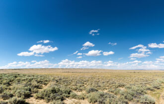
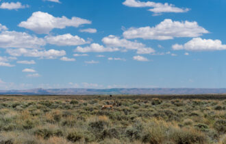
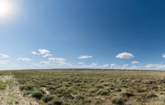
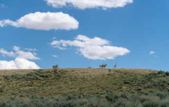
Looking for your own private outdoor paradise? This 40-acre property in Wamsutter, Wyoming, offers endless possibilities for recreation, right next to over 30,000 acres of BLM land! Whether you enjoy hunting, hiking, camping, or off-roading, this land gives you the freedom to explore the great outdoors. With legal access and a county-maintained road running through the property, you can easily reach your new adventure hub.
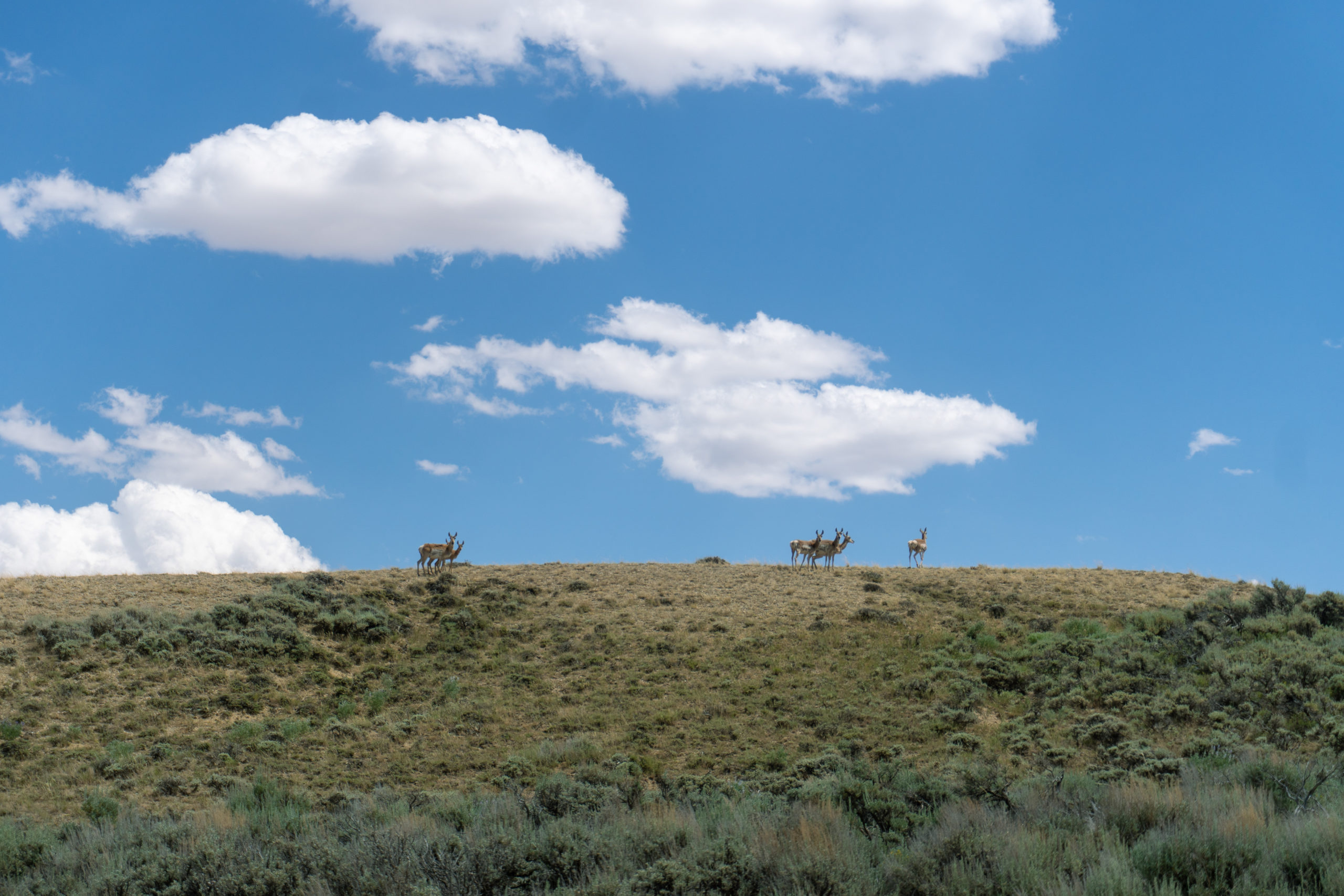
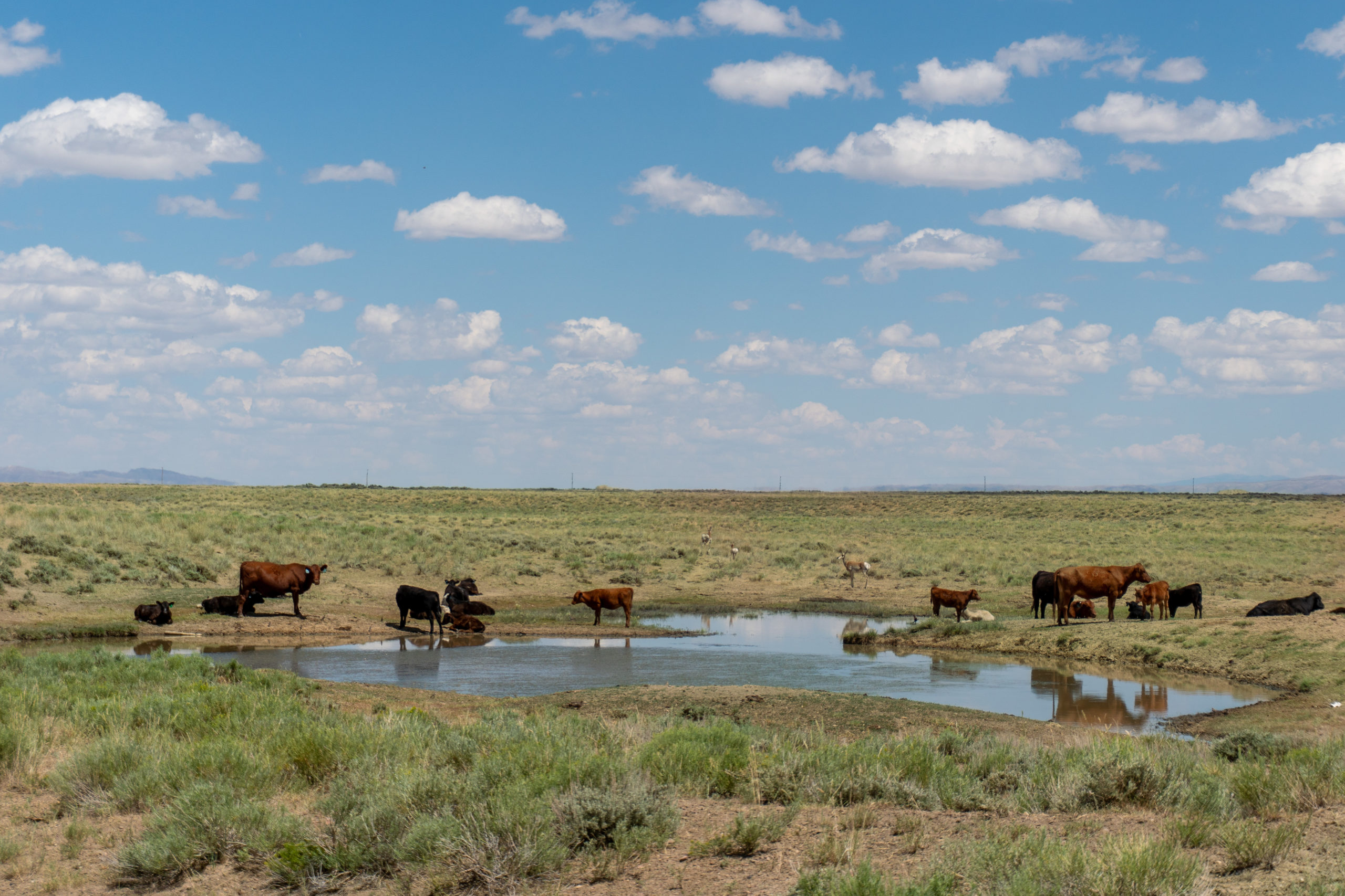
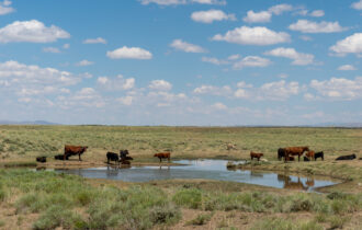
This off-grid property is perfect for non-permanent structures, allowing you to set up seasonal cabins or campsites. Solar alternatives are available for power, while you can install a well and septic system to make your retreat more comfortable. The wildlife-rich area and a seasonal pond on the property create excellent opportunities for hunting and enjoying nature. Plus, Rawlins is close by for supplies and services.
Low annual fees and flexible financing options—starting at just $5,000 down—make this land affordable and accessible. Whether you’re looking for a recreational getaway or a long-term investment in outdoor land, this property is ready to become your ultimate retreat.
Highlights:
- Borders over 30,000 acres of BLM land
- Ideal for recreation: hunting, hiking, camping, and ORV/UTV activities
- Legal access, low taxes, and only $100/year in ranch fees for road maintenance
- Wildlife-rich area with seasonal pond and abundant hunting opportunities
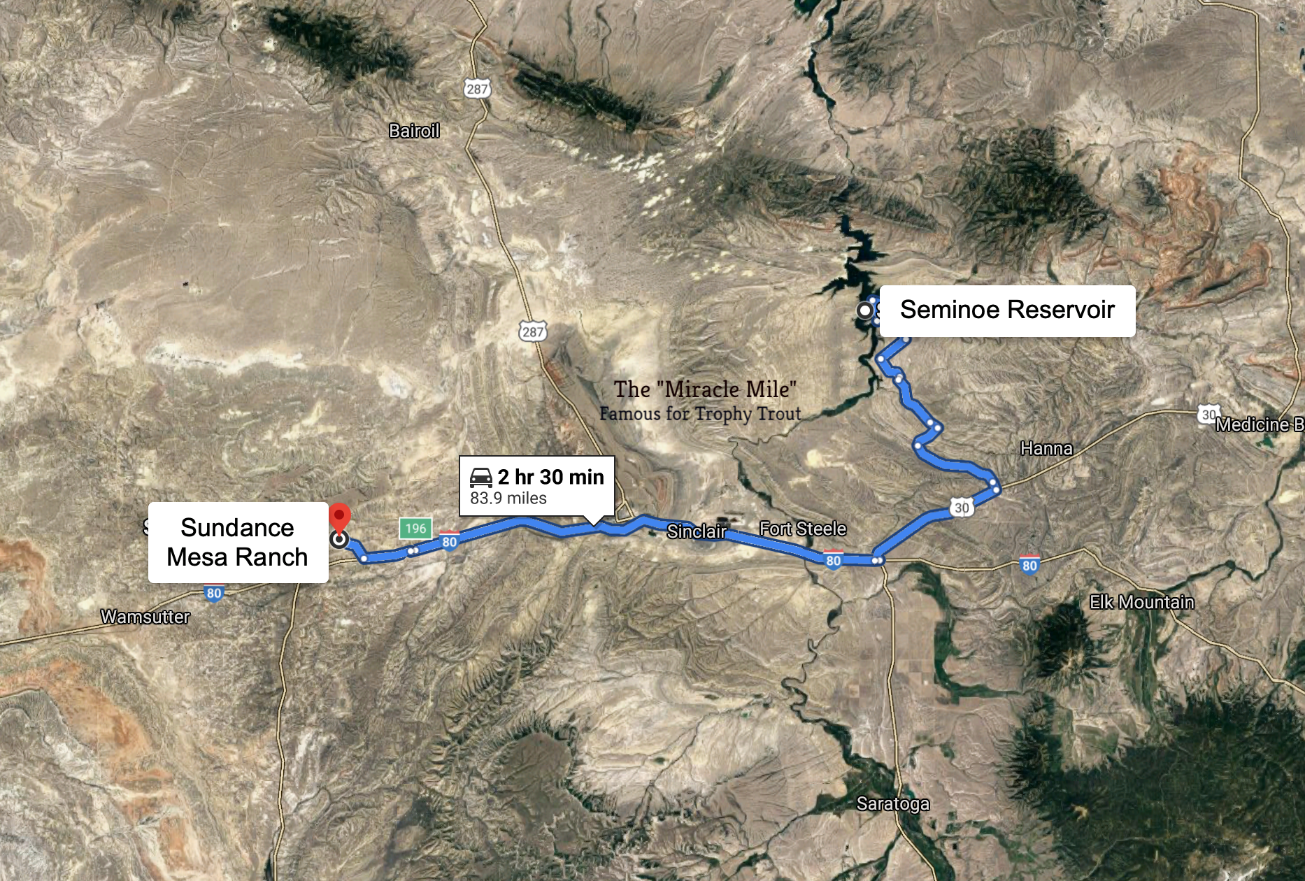
- Convenient access to supplies and services in Rawlins
This property provides a unique opportunity to own a piece of Wyoming’s rugged beauty, perfect for those seeking solitude and adventure in wide-open spaces.
Property Information
Parcel Size
40 acres
State
Wyoming
County
Sweetwater
Nearest Cities
Rawlins
Legal Description
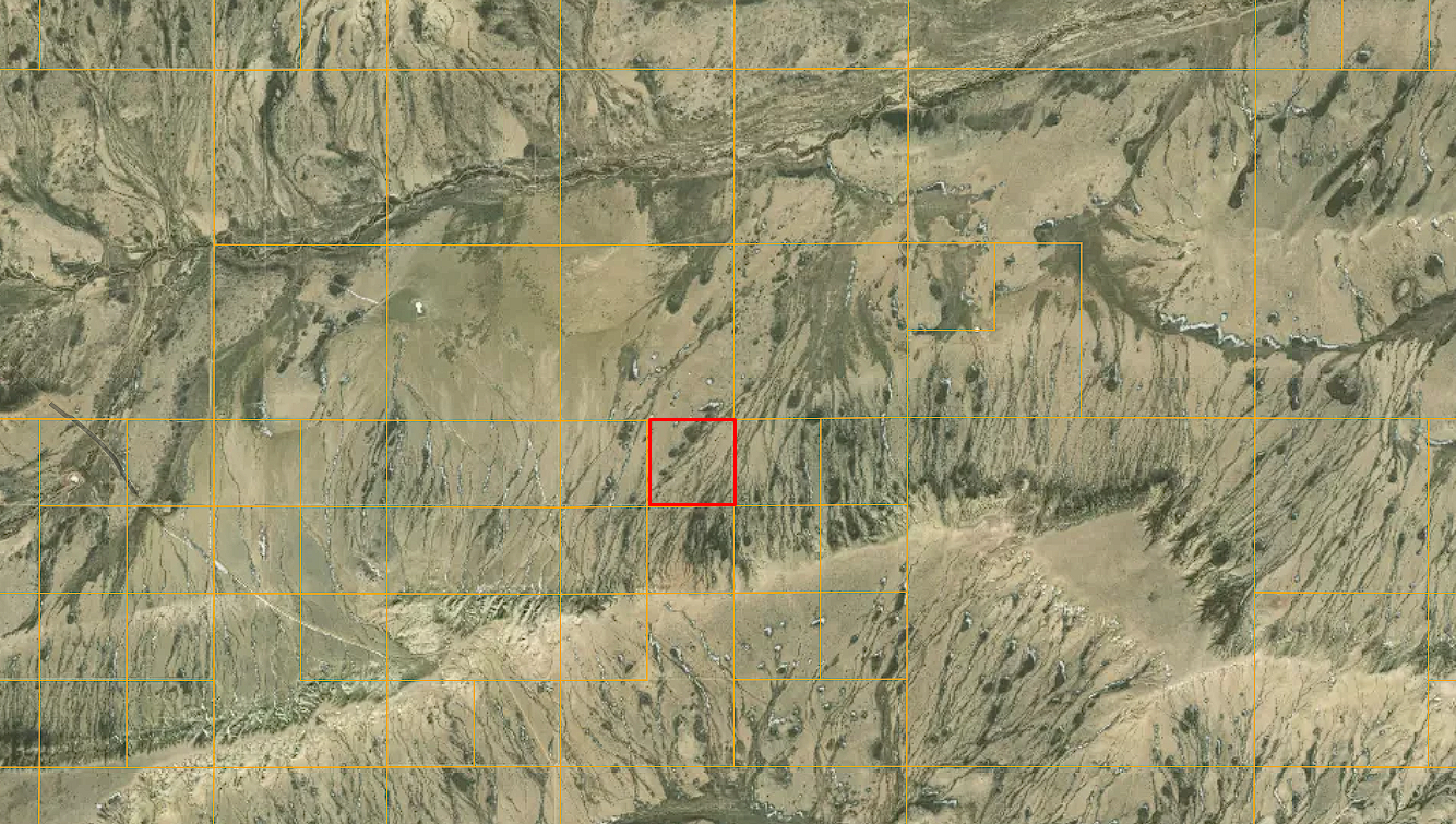
Southwest corner 1/4 of Northwest 1/4 of Section 27 Range 91 W, Township 21N (Lot #5 in Section 27 of Sundance Mesa Ranch Map)
Features
Acres
40
County
Sweetwater
Access
Maintained dirt road
Power
Solar
Water
Well needed
Coordinates
41.76791358728419, -107.63361200215294
Zoning
Agricultural
Purchase Information/Fees
$200/year
Document Fee
An additional fee of $250 to reserve the property is required to begin the purchase process. This is a non-refundable fee.
$20/month
Bank Auto-transfer Fee
This fee is only charged if you use our owner-financing option. We pass on the charge from the bank to our customers.
Other Info
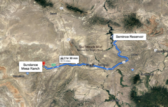
Sundance Mesa
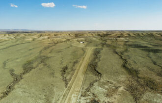
This 40-acre parcel for sale (not fractured ownership) is part of the 12,000-acre Sundance Mesa Ranch. Each lot in Sundance Mesa has deeded access with a bladed road for easy access (you won’t have to trespass to get onto your own property). For each lot, there is a $100 annual road maintenance fee due every May.
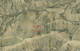
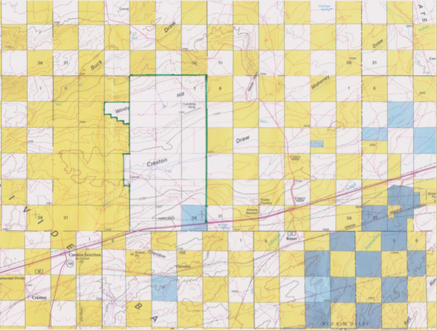
The “checkerboard” style map (shown above) shows part of the spread of sectioned land across the United States from Omaha Nebraska to Sacramento California that came from the construction of America’s first transcontinental railroad in the 1860s.
The railroad companies were granted a strip of land in the checkerboard for their railway all the way across the country, along with a grant of alternating square mile sections of land for twenty miles on each side of the track.
Today, the checkerboard sections of land that the government-owned are now part of the Bureau of Land Management (BLM) agency that manages nearly 250 million acres of public land across the county.
On the above map, the BLM land is shown by the yellow section squares, privately owned land is shown in white, and state trust land is shown in blue.
As you can see, the privately owned land with the green border shows the land within Sundance Mesa, and more importantly, the tens of thousands of acres of public land that is accessible to the immediate west.